Map reading and using maps to follow a route are useful skills, and offer some interesting, entertaining and challenging competitions for cyclists. Here is an opportunity to have a bit of practise in using our local OS Landranger No. 187 – Dorking & Reigate map, by following route instructions to one of our favourite tea stops – Ruby’s Tearoom near Beare Green. If you do not have the relevant map you can borrow one of Anerley B.C’s copies. Just ask me – Des.
So lets get started! If you have never learnt how to use O.S maps and their Grid Reference system, or need a reminder, this Anerley tutorial will help to de-mistify how the Grid system works. See https://anerleybc.org/1/map-reading-and-grid-references/
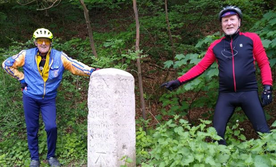
1. Milestones are normally marked on O.S maps with the letters MS. They date back to the 17 or 1800s when coach and horses travelled along the few major toll roads.
On a recent Sunday ride, Asif pointed one out to us along the Brighton Rd, just before we got to Coulsdon. Although it has been there for about 200 years I had never noticed it, and probably due to clutter in such a built up area, it is not shown on my OS map, either. However as pointed out by Asif, adjacent to it is a small new housing development accessed by a new “Milestone Drive” on the left hand side of the Brighton Rd – so instead just look out for that!
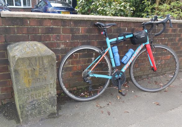
This milestone shows that on the original old coach road it was 13 miles from London’s Westminster Bridge and 38 1/2 miles to Brighton.
2. However the OS map does show the next one, up the old A23 before the new by-pass was built. Below it is as shown in a book about the history of the Brighton Rd. The London to Brighton road was a must challenge for racing cyclists – hence this drawing of the first lady to set a record, passing the milestone at Coulsdon in about the 1890s.
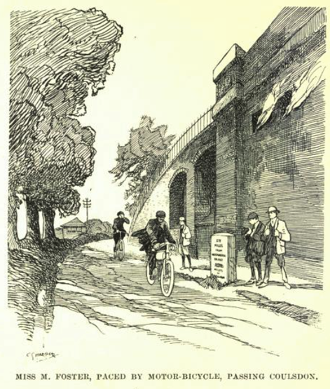
This milestone is shown on the OS map at Grid Ref 299/590. If you look carefully, you can see MS is marked on the OS map adjacent to Coulsdon railway station, where the railway (as shown in drawing above and on the OS map) crosses over the old Brighton Rd. The milestone is still in the place shown.
3. Our next map reading challenge is to find this Coal Tax Post. These posts are not shown on OS maps.
Its location can be found at the minor crossroads (yellow roads) as we headed towards Chipstead. The Grid Ref is 285/580
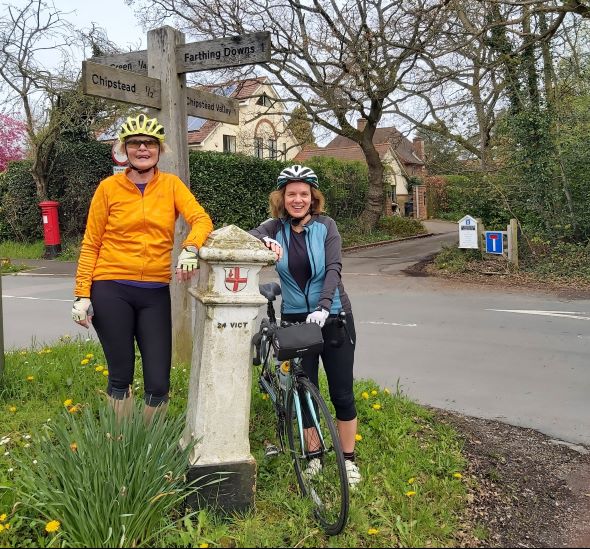
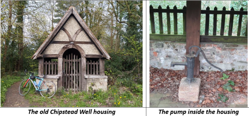
4. From there we did a left turn and followed the yellow road past a pub and telephone box (bottom right of Grid Square 27/57) and over the next X rd to Grid Ref 276/566. Here but not shown on the map, is the old village pump to a well. No running tap water in days past! And no cosy coffee or tea shops, so our Anerley cyclists would know where all the village wells/pumps where to refill their water bottles!
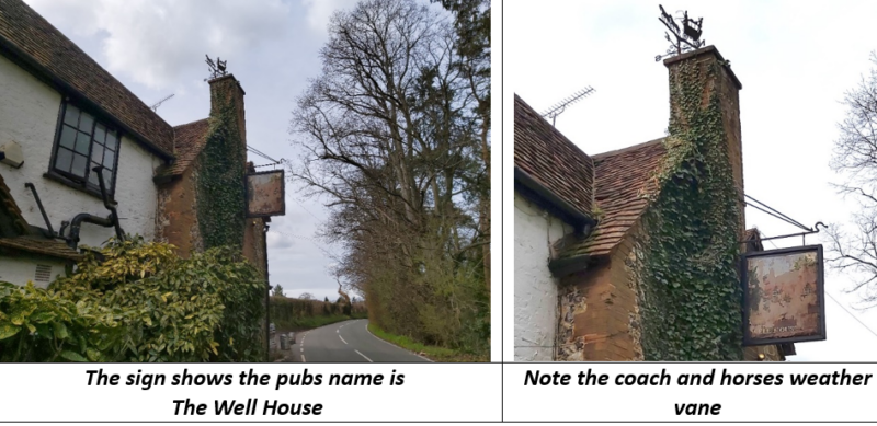
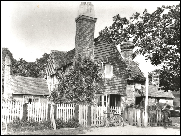
5. Continue a bit further to the next X rd at Grid Ref 276/558 and do a right turn. See the single arrow sign on the map indicating a steep downhill (14 to 20% gradient). Following this minor road, you will see PH marked on the map. Estimate what the Grid Ref is for this public house.
6. If you look a bit below on the map, you will see that this area is the little hamlet of Mugswell, which is a corruption of Mag’s Well, or the well of St Margaret. This well is still in the rear garden of the pub at No.5 above, and has been used since the Stone Age.
7. Now fast forward to Grid Square 28/54, Banstead Heath where we cycled along the B2032, past Pebble Combe and down the hill to the level crossing (LC on map) adjacent to the railway stn (with a telephone indicated on the map) at 210/513.
8. From there we followed the yellow roads due south into the centre of Betchworth village, past its church (used in the film Four Weddings and a Funeral) and The Dolphin pub, to cross over the River Mole – all identifiable landmarks and shown on the map – in what Grid Square?
9. It is then a straight road heading south to the Seven Stars pub on the T junction. Here, head south east to the nearby Plough Inn on the next X roads, with a nice old church opposite – can you provide the Grid References of these 2 pubs?
10. You should all know this area well and have no trouble heading off to Newdigate, passing on the way the Surrey Oaks pub just after a T junction where you would turn right. What is its Grid Ref?
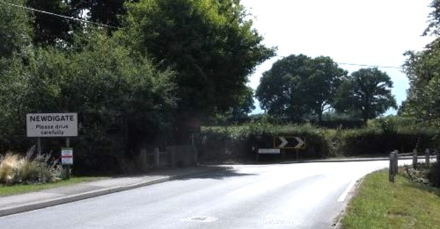
11. In the village at Grid Ref 196/423, just before the parish church, do a right turn and continue thru to join the A24 at Beare Green at an extended roundabout (see map). At the head of the roundabout take 1st exit onto the minor (yellow) road which is signposted to Capel.
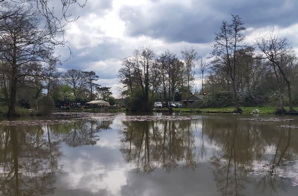
12. It is now only a half mile to the tea stop, Ruby’s Café at Hoyle Lake, which you can see at Grid Ref 176/420.
So you have found your way to the morning tea stop – well done!
Des.