In the last week of November we had our first early morning frosts and temperatures that struggled to reach 5c later in the day. The only good thing about the weather was that frosts are usually accompanied by a blue sky.
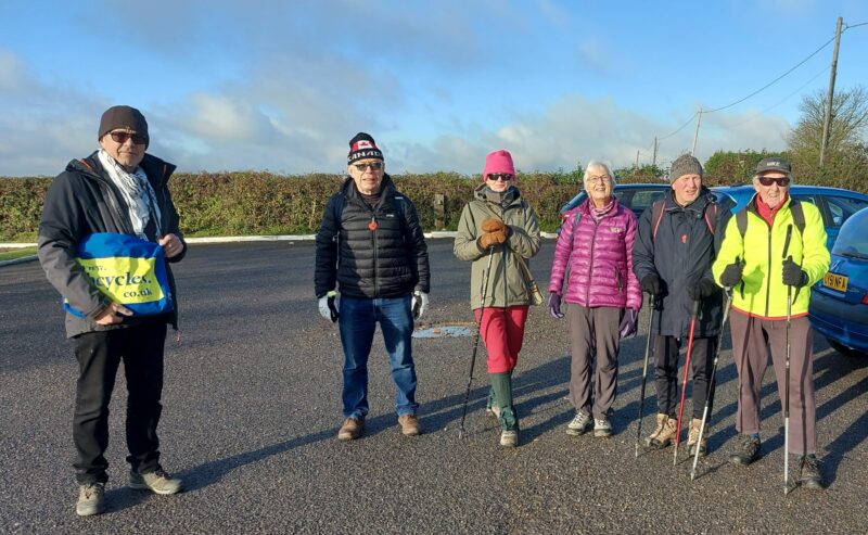
I hate cold weather and don’t enjoy cycling when the mercury drops to zero. For me, the enjoyable answer is a winter hike – a change from cycling, and the opportunity to see country vistas and so much more, when not having to look out for the myriad potholes on our roads and country lanes. So I advertised an Anerley Hike on the Ride Register and ended up with the the six shown below – plus Asif who took this photo of us meeting up at Botley Hill Farm. And note the blue sky!
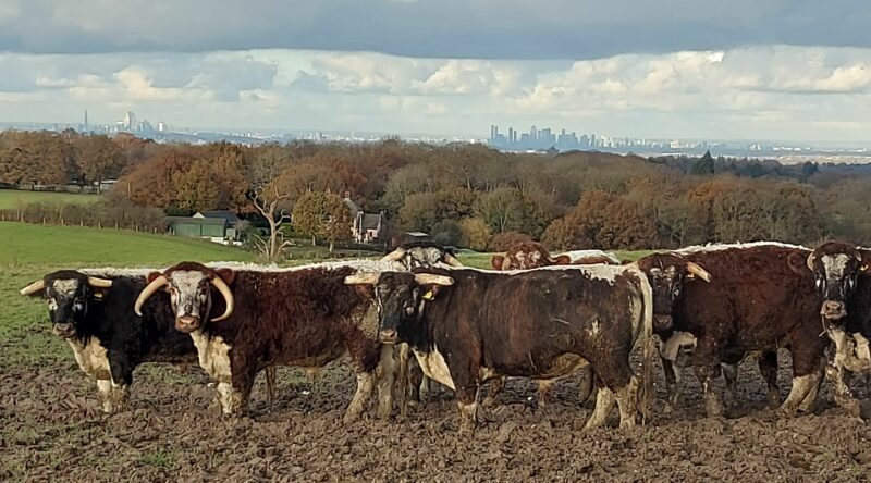
The seven off us set off from the hill farm and straight away had country views to right and left, as we walked along Limpsfield Rd – the top of the ridgeway – to start our Hike at a signposted footpath. This actually being a wide farm trackway. But look at the view of the cattle and the City of London and Canary Wharf in the far distance. You would not see that on a bike ride!
We then passed thru a woodland with pheasants flying off, disturbed by our presence. The wooded area to our right was fenced off with access via a padlocked security gate, obviously an area used by a gun club. Then we came to open ground with a very steep descent into a valley. Here the walking poles came in very useful because it was very slippery after the previous 2 days of heavy rain showers.
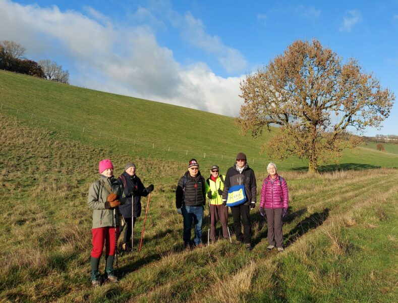
Above, we made it safely to the valley bottom – and Asif our camera man – makes 7.
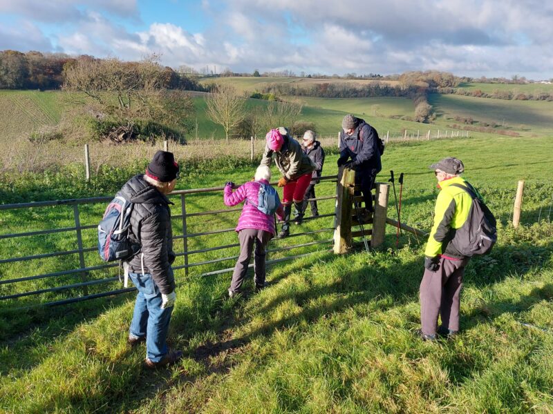
From the valley bottom we had an even steeper climb, which took us up to Beddlestead Farm and our first hurdle to overcome. A locked gate which should have given us access onto the public bridleway of the Tatsfield Border Path. But we managed to straddle this hurdle, just!
We headed west along the bridleway which was very narrow, with woodland on our right and a barbed wire fence on our left overlooking the green fields and valley from which we had just come. One reason for this hike was that I was looking for routes for potential Gravel bike rides along bridleways. But not this one! The centre of this path had been worn into a rut about 9 inches wide and deep. The slightest wobble on a bike and you would end up attached to the wickedly barbed wire fence!!!
And now a bit of map reading!
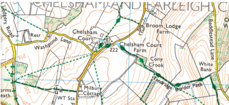
You can see Beddlestead Lane on the right, and the Tandridge Border path weaving it’s way between woods and fields. And the many contour lines showing the challenging, steep ups and downs of the hills and valleys. But what is the faint, little blue symbol where the Border Path meets the road adjacent to the telecom mast?
Frank Kippen was the only one in our group who knew what it represented, being a civil engineer by profession. If you don’t know, it looks something like this:
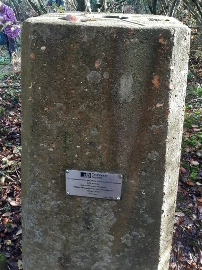
This large concrete marker is known as a “Trig Point” and is represented on maps by the little blue, triangular symbol. Both are known as a “Trig Point” because they mark one of three apexes of a geographical triangle used in making maps.
Read the plate near the bottom of this concrete block, and it says “O.S Ordnance Survey” who just happen to produce O.S Maps!
The original meaning of “ordnance” was a term relating to military equipment, such as for example – swords, cannons, muskets, etc.
A new bit of military “ordnance” – maps! – proved their worth during the Jacobite Rebellion (Bonnie Prince Charles, Battle of Culloden – 1746 – and all that) – and maps have become known as “Ordnance Survey Maps.” An interesting story for a future Gazette item!
But at this point the troops were becoming mutinous – “Are we there yet?” – “Where’s the tea stop?”
So it was a “Quick March!” to the nearest pub. And Part 2 of this Winter Hike will be put on ice until the next Gazette.
Des