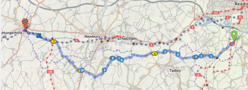
A dozen Anerley members have signed up to do this ride on Saturday 9th April. It offers the opportunity to explore a new and different area, popular with cyclists due to it’s varied scenery, quiet country lanes and little villages with ancient churches and thatched cottages. It is a circular route starting at Grazeley, a small village just south of Reading, and heading out to Hungerford for the lunch stop – 29 miles – south of the River and Kennet Canal. The return route to Grazeley is a bit longer, at 33 miles, via a route north of the River and Canal.
Below is our route out to Hungerford. Above it, is a dotted route passing through Newbury and Thatcham. This is National Cycle Route 4 – https://cycle.travel/route/kennet_and_avon A great ride for gravel bikes – 100 miles from Reading to Bristol following the Kennet and Avon Canals. There are several other blue and red dotted cycle routes, showing that it is a cycle friendly area!
To aid those who have entered for this ride, I have used the organiser’s route instructions https://www.aukweb.net/routes/51r.pdf to create two GPS files which can be downloaded to Garmin, Strava and other satnav devices. I would suggest that all of you who use satnav devices, do download the routes, just in case for any reason you should get separated from our groups – or your group leader gets lost!
The above section of the route out to Hungerford is here https://cycle.travel/map/journey/290858
And the return leg from Hungerford to Grazeley is here https://cycle.travel/map/journey/290885
When you open the above maps, on the left side of the route map, is a menu box as shown below.
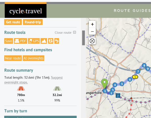
Under “Route tools” the 3rd box from far left is marked GPS. Click on it and it will open up the directions on how to download the GPS file to your device. If you have any problems contact me so that I can give you some help. Click on the next box (to the right) if you want to see where the hilly bits are!
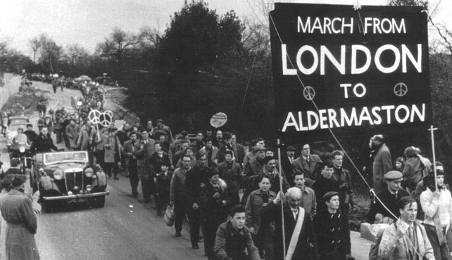
About 10 miles into our ride we pass through the village of Aldermaston which was very famous in the 1960s due to the Campaign For Nuclear Disarmament marches, the first of which was in 1958. There was (and probably still is) a vast military complex in this area, where our nuclear weapons were developed and maintained.
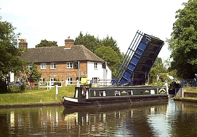
Unfortunately we do not go to the northern end of the village, to Aldermaston Wharf, a much more peaceful place in history. But you would, if you were cycling the Kennet and Avon Canal, NCR 4. This was a major trading and transit route, before the railways took their place in Victorian times.
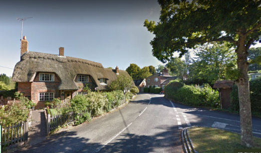
But instead, you will see some lovely thatched cottages like this one on the route to Hungerford. From memory, this was near Kintbury, with me, mountain bike and panniers in the shadows!

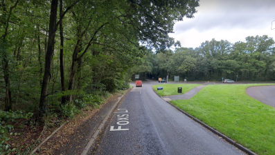
Along the route there are a number of check points to show that you have not taken any short cuts. Remember to take a pencil/biro to get your Brevet Card signed as proof. The first check point is about 20 miles into the ride, at a cross roads before you get to Hungerford. It is on this green area in Foxes Lane and there are 3 more on the return leg.
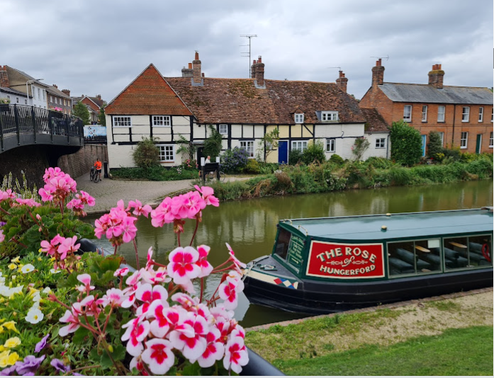
On the outward leg, you won’t see the River Kennet until you get to Hungerford, where the lunch stop is by the bridge over the river

And our lunch stop http://thetuttipole.co.uk/ is adjacent to the bridge and overlooks the river as shown below. You may wonder how it got the strange name of Tutti Pole. It is explained in the History section of their web site.
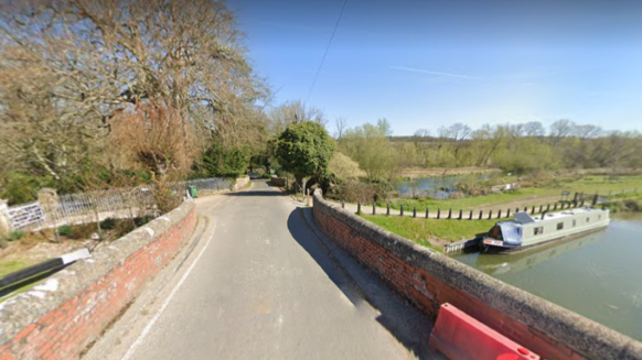
After this official lunch stop we start our return journey https://cycle.travel/map/journey/290885 by the same route as we came in, through Hungerford Park, originally a manorial deer park dating back to the 1200s. From there we head north east crossing over the River Kennet, following Dark Lane. Dark because this used to be a trackway through Savernake Forest.
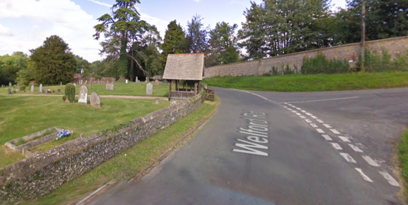
We then wend our way back, through many little hamlets with thatched cottages and lovely old churches, to Grazeley. The route gets tricky now! For example, in the absence of a sign post, the route instructions tell us to make a right turn in the village of Welford opposite the lyche-gate at Welford cemetery and parish church. So fore warned!
We also need to look out for the above thatched cottage in Boxford. It marks a right turn, opposite, that we must take.
And there are more such twists and turns that we need to keep a sharp lookout for. Now you get some idea of why we may need, or should it be, will need, some help from GPS route files to keep us on track!
Des.