Part 2: New Mexico
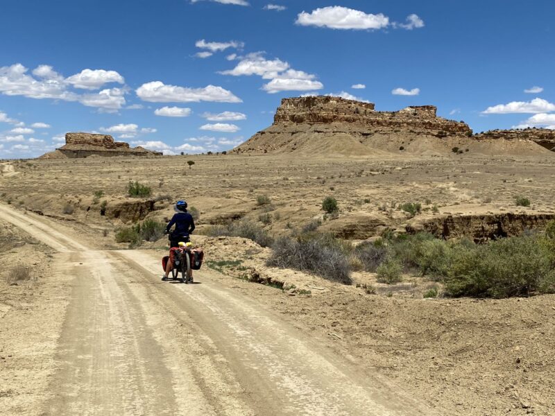
The bike lurched to the left and I just about saved it by throwing my weight around and steering into the skid, only to be lunged into a righthand skid. I had become over confident and hit a stretch of sand while descending at speed. I quickly threw my weight in the opposite direction and steered again to temporarily regain control, braking gently to try and kill some speed. I continued to snake down the track on the edge of wipeout until I ground to a halt, my heart racing and breathing heavily. I looked back at my sinuous track and saw Sally cautiously start the descent. It had been a close call. I’ll never know how I didn’t come off.
Getting injured or damaging the bike miles from help was not a good prospect and we both made mental notes to be more careful, with the emphasis on avoiding injuries rather than making swift progress. After all we were not racing and taking a few extra minutes was insignificant compared with the delays of dealing with the consequences of a broken bike or body.
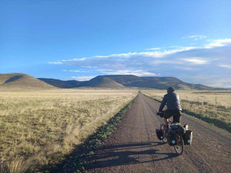
New Mexico is the 5th largest State and is sparsely populated. It’s nearly 30% larger than the UK with only 2.1 million people; a density of 17.2 people per square mile. The UK has 278 people per square mile. When you consider most people live in the towns then the countryside is practically empty.
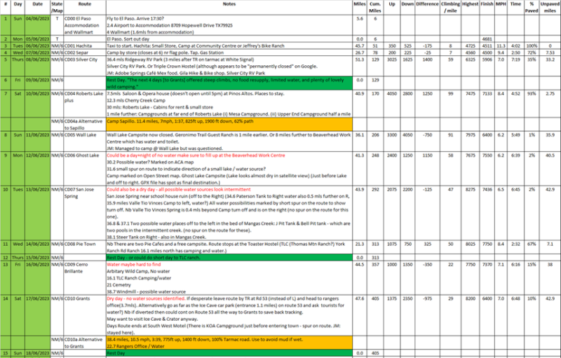
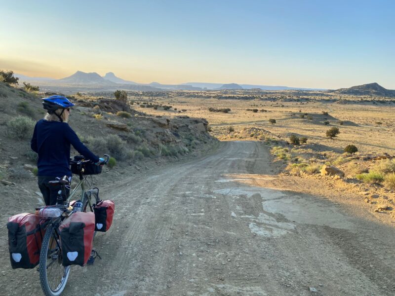
The GDMBR route through the State is around 700 miles and we planned to take 24 days to reach Colorado allowing for some contingency and rest days. This meant we should leave New Mexico before the rainy period in July/August and also keep us on track for leaving the United States before our visa expired (90 days). It climbs from around 4,500ft to 6,000 – 7,000ft and then to over 10,000 feet.
Below is an extract from my planning. I tried to take into account the climbing, road surfaces, the suitable places to stop, water and re-supply points. I avoided sleeping at the highest points to help us acclimatise to the altitude. The speeds and times were what Kamoot predicted. Although not accurate they did give us a guide to the relative difficulty of a particular day.
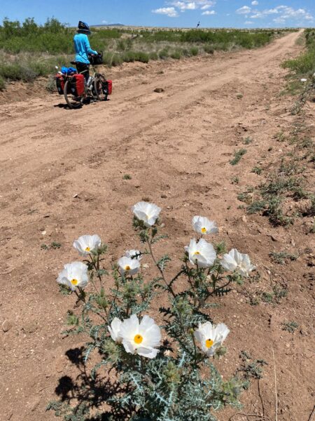
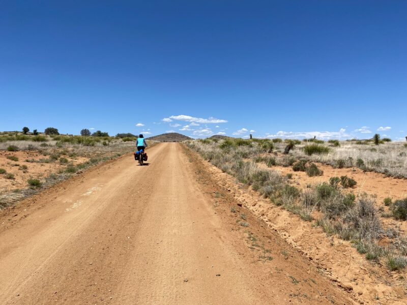
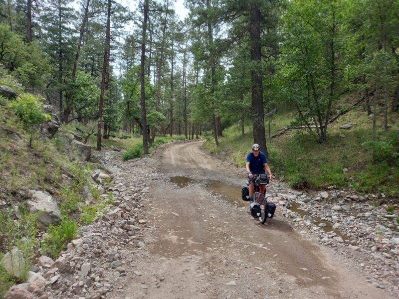
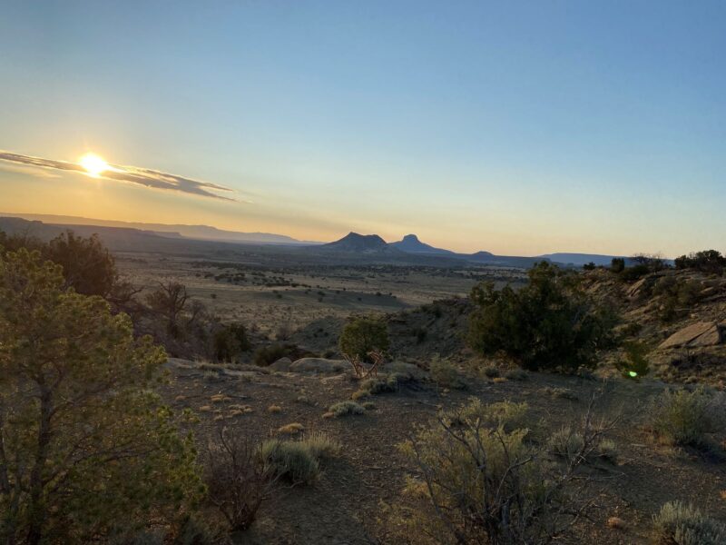
We left Hachita Community Centre at first light, to avoid the heat. This became a familiar strategy as the temperature sored by mid-afternoon. At first our surroundings looked devoid of life; scrubby semi-desert but, as our eyes tuned in, we saw lizards, gophers and birds of prey. The first 20 or so miles were on an easy tarmac’d road so we arrived at the store/gas station at Separ for breakfast. We now had a dilemma; stay for the night or tackle the 50 odd miles on dirt road to Silver City, our first proper town. It was too early to stop so we pushed on, crossing under an interstate highway and over a railway line to reach the end of the tarmac. We were on our first dirt road where I had learnt a lesson about being more wary of unexpected patches of deep sand.
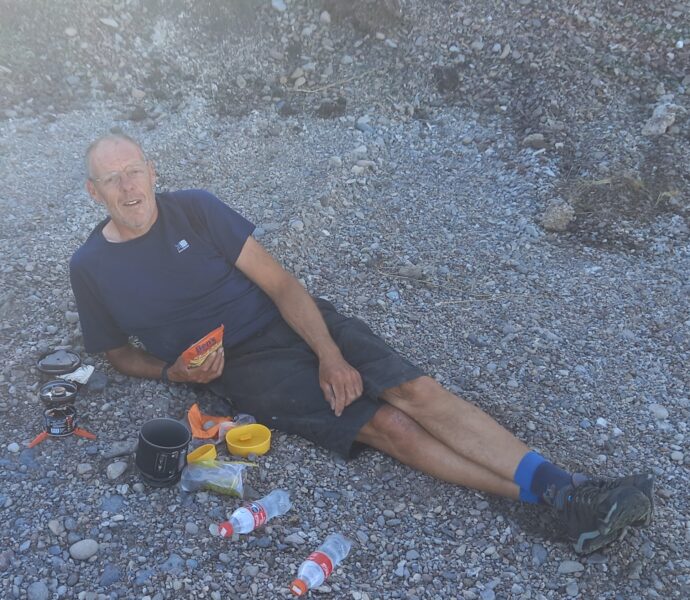
With the heat, sweat and being bumped around on the corrugated tracks, I managed to develop a blister on my rear which burst and was very uncomfortable so it was with some relief when we rejoined tarmac on the outskirts of Silver City. When I say “City” it was smaller than Wallington and had one main street. It had been a hard day of almost 80 miles and we were tired. On the plus side we were a day up on the planned schedule so we treated ourselves to a hotel knowing this wouldn’t be an option on most of the trip. We had our evening meal in a lively pub with baseball on the TV.
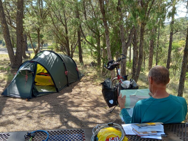
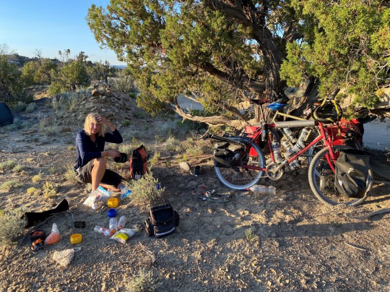
Over the following few days, we started to climb into the forest and enjoyed cooler temperatures. None the less, Sally was determined for us to continue with the early starts. With ice on the panniers some mornings I was less keen, so Sally developed the technique of letting the air out of my air mattress, forcing me up after a few minutes to avoid the pain of lying directly on hard ground. We settled into a routine. I got up, unlocked the bikes, retrieved the bear bags, started to load the bikes, cleaned my teeth while Sally packed away the bedding. By the time she emerged I had already taken out most of the tent pegs ready to collapse the tent. Then while Sally was packing her last few items and doing her teeth, I packed the tent. Generally, we were packed and ready to roll in half an hour. Breakfast, which didn’t consist of very much, was taken an hour or two down the trail.
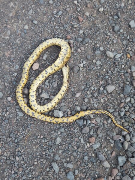
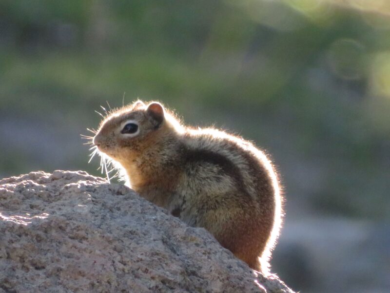
In the forested sections we spotted deer, squirrels, chipmunks and large yellow and black butterflies. We camped at official sites that usually had water and a drop toilet or sometimes just a toilet or we camped wild. The 3rd day saw us walking with our first steep climb on dirt roads. We wondered how we were going to manage the rest of the journey if we were already walking.
We passed a small hamlet of Pinos Altos that boasted a saloon and, surprisingly, an opera house. The hamlet was advertised as historic having been founded in 1860. It dawned on me that the “Wild West” wasn’t that long ago and in a lot of places it still had the feel of those times. New Mexico was the 47th State to join the United States, joining in 1912. Prior to 1848 it was part of Mexico. The Spanish Colonised the area in the 1600’s but the 1800’s were about as early as any historic buildings we saw.
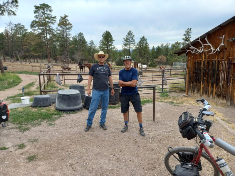
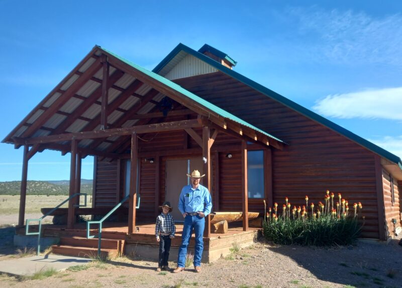
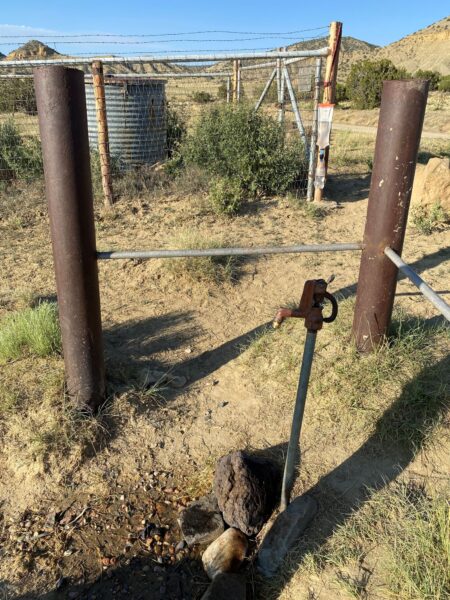
We met our first cowboy, a tall man wearing a Stetson hat, at the Germino Guest Ranch. We were hoping we could stay the night. The clue is in the name of the ranch; right?… Nope! At first, he was a bit grumpy and asked us what we wanted as he pulled up in a massive pick-up truck at the entrance to his ranch. He informed us that the ranch was only for guests on horse riding packages and was obviously a bit irritated by being bothered by cyclists. Sally complemented him on his beautiful horses and he softened a little and let us re-fill our water bottles from a ground water pipe. He was proud of how pure the water was and explained that his grandfather had established the ranch and that he was self-reliant – water/power/security (gun). As we left to pitch our tent on nearby public land he went to his truck and returned with an energy drink and bar for each of us.
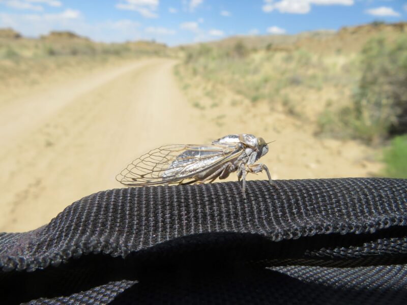
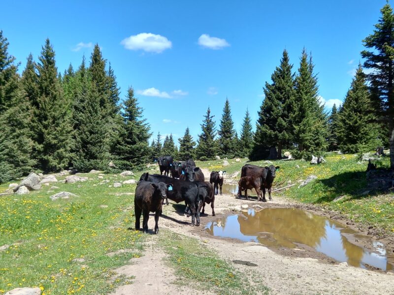
Over the next few days, we travelled through forest on the higher ground and then through barren ranch land at the lower elevations. There were a lot of Black Cattle that I had been concerned about before I left home but turned out to be incredibly docile. We also saw Elk, Foxes and Hares and clouds of grasshoppers.
A note on the map mentioned we could get water at a remote church but only on Sundays. Fortunately, it was Sunday when we passed through so we called in. We were met by a small boy playing in the garden. He was dressed in jeans, Stetson and cowboy boots. He ran in to fetch his parents. The vicar was similarly dressed and agreed to us re-filling our water bottles.
Attached to the church was a large hall and kitchen. The vicar explained that they were preparing for the congregation to arrive. Many of them would travel for several hours on dirt roads to get there, so as well as the service they would all eat together and proceedings would last until mid-afternoon, after which they would jump into their trucks and drive 90 miles home! I guess it kept the dispersed community together.
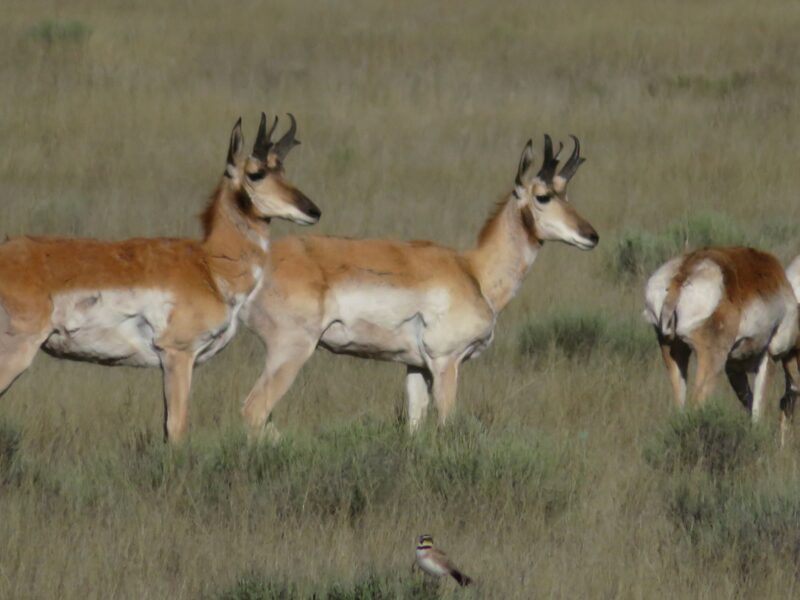
In the ranch land we started to spot Prong Horns; a type of antelope with distinctive horns and white posterior.
Back in the forest it felt like bear country and every black rock started to look like a bear. I didn’t really expect to see one, as the density of bear numbers was supposed to be low this far south.
Then in my peripheral vison I thought I saw something move to my right. I was just starting to think it was my imagination when I saw the bear reappear on the far side of a gully beside the track. I stopped. The bear stopped, probably 50 metres away, and looked at me. It then turned and scurried further up the hillside before turning to give me a final stare and disappeared. Sally arrived having missed the whole encounter.
I had expected to be terrified but actually I didn’t feel at all threatened and just felt blessed to have had such a wonderful experience. It did make me think that we should travel a bit closer together as it would have been difficult to warn Sally had the bear got between the two of us on the track.
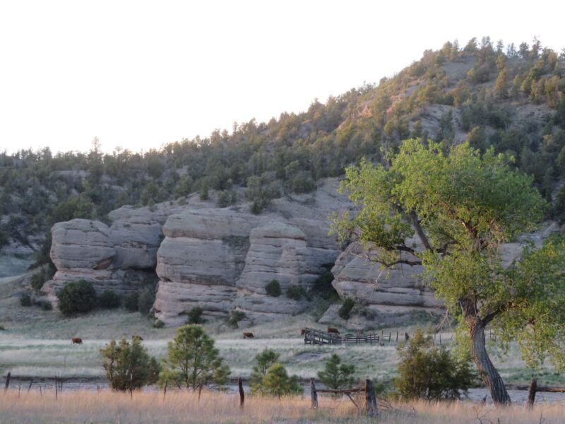
We travelled through canyons and strange rock formations reminiscent of black and white westerns of my youth. I was half expecting to be ambushed by Indians.
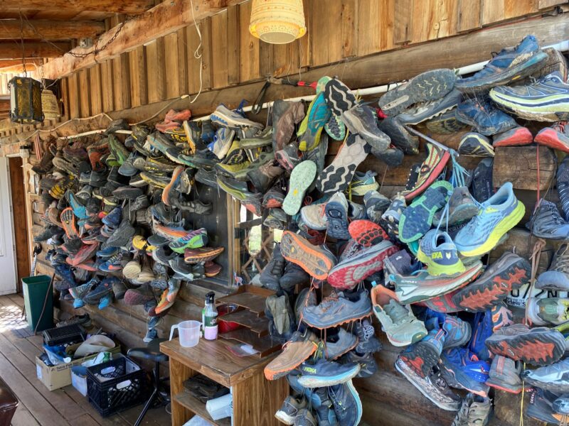
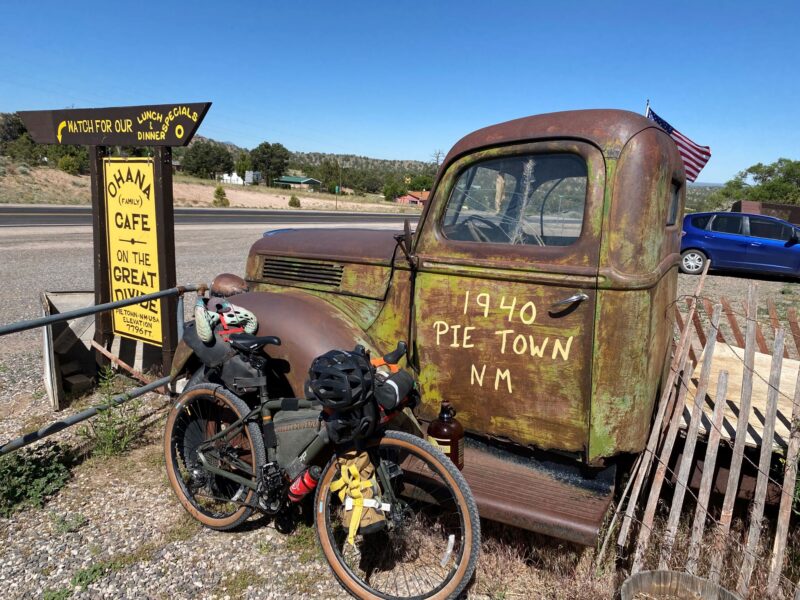
A few more days down the track, we arrived at one of the iconic stops on the route; the Toaster House in Pie Town. The Toaster House is a popular stopping point for cyclists and hikers doing the Great Divide. It is called the Toaster House as all along the boundary fence and around the gateway arch are old toasters. The Hostel is used as a re-supply point for hikers that send new walking shoes and discard their old ones, hanging them on the veranda; there must be hundreds.
The Hostel is run on donations; i.e. you pay what you can afford or feel it was worth. The hostel provides beds, showers, kitchen, some food and fresh eggs for you to cook with if you wish. There is a bike stand and bike tools in the garden. It had been run by an old woman who had recently died. She evidently was quite well off. Since she had died her children have employed a volunteer warden with the aim to break even. I certainly hope it does or it could disappear. It is a great place to meet fellow cyclists and hikers and hear their stories.
We heard stories from a previous year where Southbound racers pushed on into the mountains when heavy snow was forecast and they were advised not to. They got trapped and could not go forward or retreat and had to summon help using the emergency button on their trackers. They were rescued by helicopter after getting hypothermia. The race adds a level of danger because of the competitive drive to keep going and because racers reduce their kit to the absolute minimum.
We also met one guy who had started the race the previous year from the North. Early into the race his front wheel rim collapsed on a descent. He was found wandering around carrying his bike concussed. This was to be his second attempt but was already suffering with a cold and hacking cough. He gave up a day or two later.
Most racers give up in the first week or are relegated to “touring”.
We heard a more worrying story for us, from the warden. Apparently, some hikers had been re-filling their water bottles from a cattle trough not far away when the landowner took exception to this and fired 20 rounds at them! What was even more concerning was the local’s opinion of this. Their view was “Didn’t the hikers know it was dangerous. Why weren’t they carrying guns?” The thought of having a shoot-out with a cowboy who regularly hunts and has probably grown up with guns from an early age didn’t bare thinking about.
We were also warned about the town of Cuba, a few days up the road. Some ranchers and shops around Cuba hate cyclists we were told. One rider had had his electronic gear shift battery stolen in Cuba. Well, that was one thing they couldn’t steal from us! Electronic gear shift was way too sophisticated for this sort of ride.
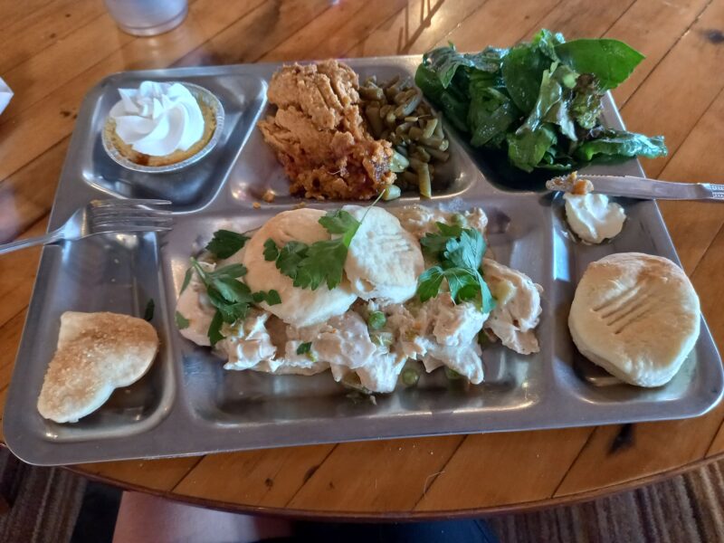
Toaster House recorded 900 visitors in 2022. This was causing a bit of controversy with the locals as the Toaster House was often exceeding its water quota. On the other hand, it was bringing trade into this small community (186 people). The town is so called as it had a bakery in the 1920s that was famous for its apple pies. Pie Town now has two Pie Cafes producing all types of savoury and sweet pies and has a Pie Festival in September. We tried both cafes; one for an evening meal and one for breakfast. For the evening meal we went to the cleverly named the “Pie-o-neer” where we experienced our first meal to include “Gravy and Biscuits”. The biscuits are actually more like scones.
Just before we reached the Toaster House my rear tyre, that had given good service on the entire length of the Chile/Argentina trip, was bulging and making the bike wobble. Sally spotted an old mountain bike in the ramshackle garden so I asked the warden if I could take the tyre off as a spare. She agreed. Although the tyre was old and weather beaten it relived some anxiety that I had a backup should the bulge get worse.
We had a half day ride to the TLC ranch which allowed cyclist to camp near the entrance to the ranch and provided a compost toilet, fresh water, a few apples and a table and chairs. Here we met two girls from New Zealand who were planning to live in Canada after the Divide. We had met the owner of the ranch opposite at the Pie Café and she had told us she had twice seen mountain lions wander across the end of her drive!
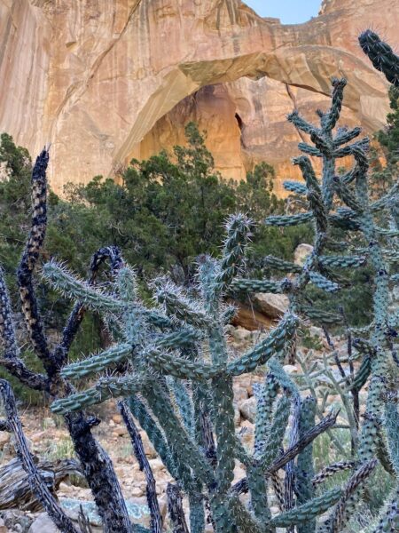
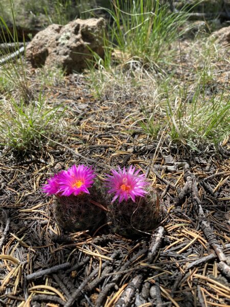
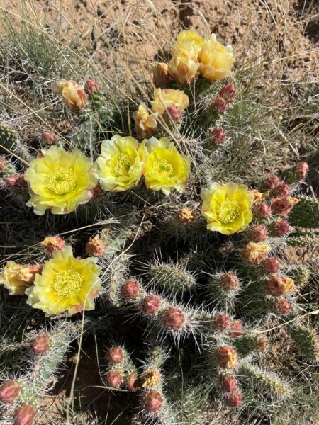
The next day we cycled through lava fields, and beside sandstone cliffs and a huge natural arch. The cacti were flowering bright yellows, reds and blues.
After 60 miles, predominately on paved roads, we reached the outskirts of Grants; a reasonably big town that had a Wallmart. Here we bought two new mountain bike tyres, one to replace my bulging tyre and one to give Sally more confidence off road. We kept her old tyre as the spare and ditched the tyre from the Toaster House.
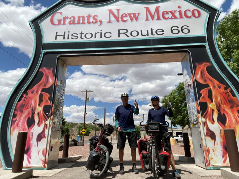
Once in Grants we posed for photos with the famous Route 66 signs which cuts through the town and decided to take our first rest day. We spent an embarrassing amount of time in Macdonald’s enjoying their air conditioning and WIFI….oh and the odd burger!
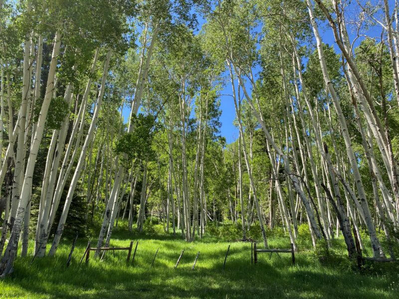
After Grants we climbed back up to 9,200 ft through Red Woods and then Aspen Forest and started to feel the altitude. Every now and then we would suddenly find we would have to pant and gulp in some extra air.
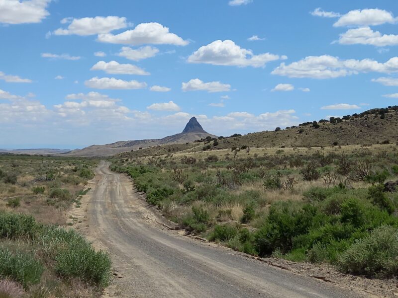
From the forest we descended again into a very arid area. There was no shade and it was very hot, in excess of 40 deg. The scenery was stunning; isolated pointed peaks, others square surrounded on all sides by spectacular cliffs with scree slopes around the base. The track was hard going with lots of sand and numerous short sharp climbs in and out of dry river beds. After 65 miles we stopped exhausted and short on water. We had almost run out of water and had to ration ourselves overnight to ensure we had some for the next day. Our mouths dry and with slight headaches it was not a great experience. Every sip became precious.
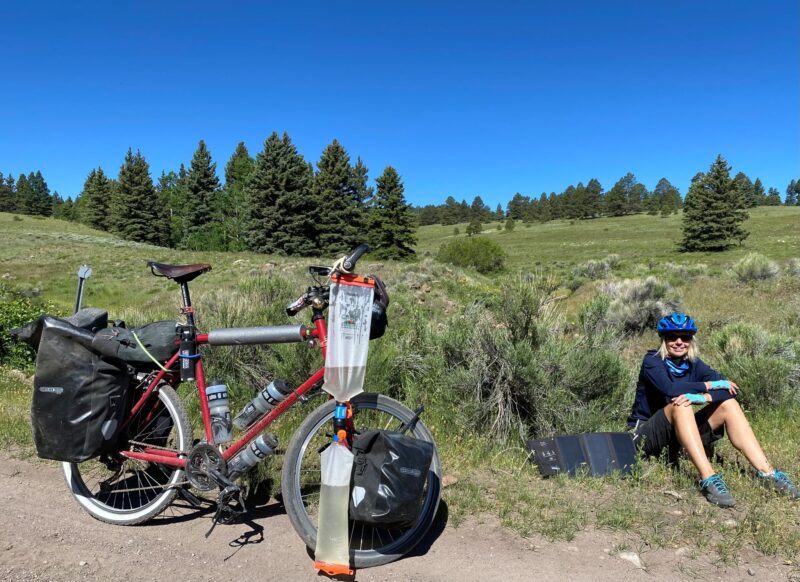
As it turned out, a few miles into the next day, the water source I had identified a mile off the route was running. We filtered the water even though it smelt and looked good and was from deep underground. We also drank as much as we could. We had learnt our lesson and on these drier sections we now carried 7 litres of water each instead of the 3 or 4 litres we had been carrying.
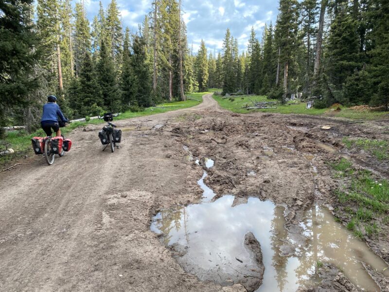
We continued to make slow progress on the tracks so decided to give ourselves a break and use a section of highway into Cuba. The Highway had a good shoulder but was a 70mph road with large trucks and vehicles with massive trailers hurtling past. It was like riding down the side of the A3 and a bit scary at times.
Once in Cuba we re-stocked and then searched for the campsite. It had changed hands and was no longer a campsite but we were directed to a ramshackle building on the opposite side of the road which was a hairdressers and beauty parlour belong to an elderly woman. Contrary to what we had heard at the Toaster House about Cuba being unwelcoming to cyclists she agreed to us camping in her back yard.
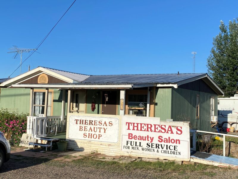
A client of the beauty parlour warned us not to drink the water due to local mining activity; apparently it was safe but not palatable. She volunteered to get us some bottled water while she was in town. She came back with 5 gallons!
We talked to Mexican workers who were living out of a caravan. They were working on a solar project and talked about the backhanders they had to pay whenever they went home to their families in Mexico.
We cleaned our bikes and panniers from all the dust and fixed two of Sally’s panniers whose fittings had worked loose.
From Cuba we were climbing once more into Pine & Aspen Forest where we found many locals camping.
How they managed to drive huge RVs and massif trailers up the tracks I don’t know. Despite my concerns there was plenty of water and we needn’t have carried all that extra weight.

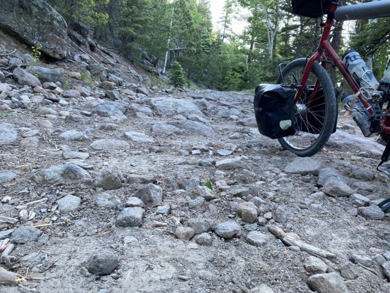
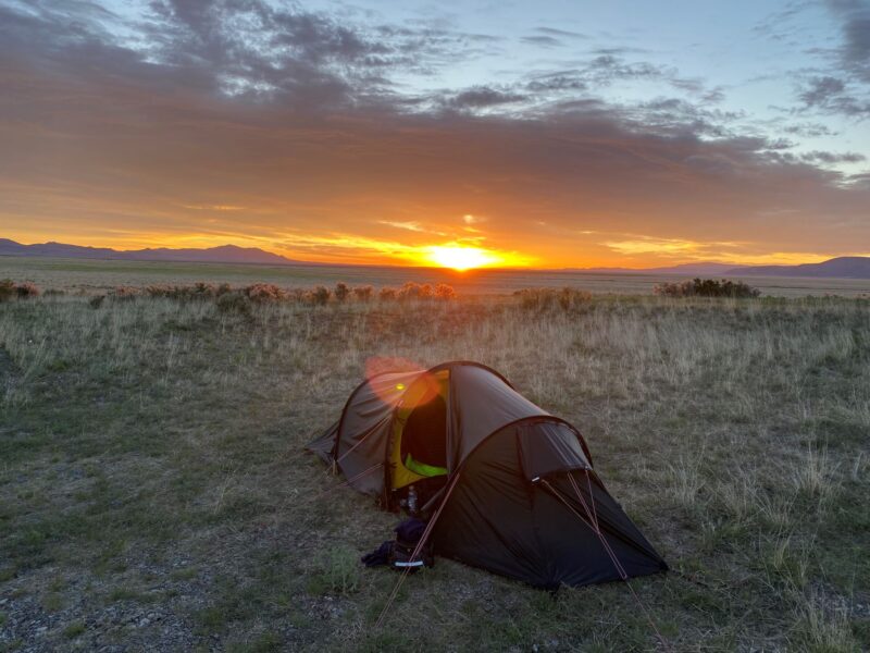
We wild camped in the forest for the first time and cooked 100 yards from our tent to avoid attracting animals. We woke at dawn to the sound of howling Coyotes. The track deteriorated as we tackled the last 5 miles of the climb and we were soon pushing our bikes over boulders. We were encouraged by the knowledge that once over the top there would be 37 miles of decent into Abiquiu. This optimism was soon shattered as the terrible track continued for the majority of the descent and meant painfully slow progress. We were averaging round 5 mph. Either slow jarring riding or awkward walking with the pedals inevitably banging into calves.
To make things worse we left the shade of the forest and it was very hot. We couldn’t imagine what it would be like going the other way. We arrived at 5ish exhausted. Again! We staggered into “Bodes” a store/café/tourist store on the main road and ate and drunk as much as we could. Once revived we found “Riverside Retreat” besides the large Rio Charma River. We could have camped but elected for the luxury of a proper bed.
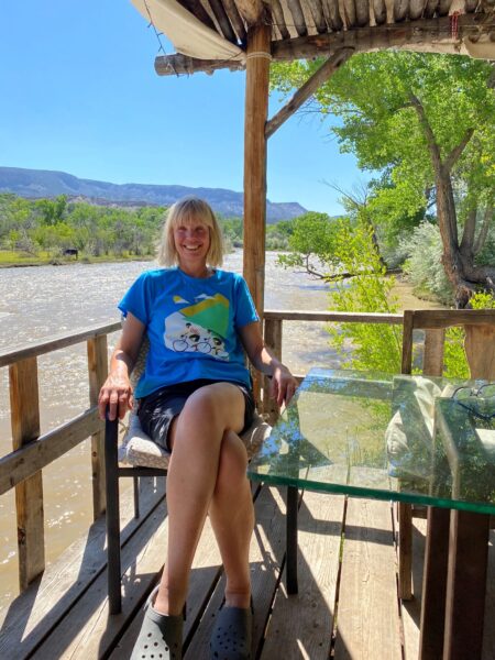
The owner laughed at our classification of “luxury” as we were staying in an old chicken coup with no electricity! It was a lovely spot with shade and a platform over the river to relax so we decided to take our second rest day. We had covered just over 600 miles and were 5 days ahead of my planned schedule.
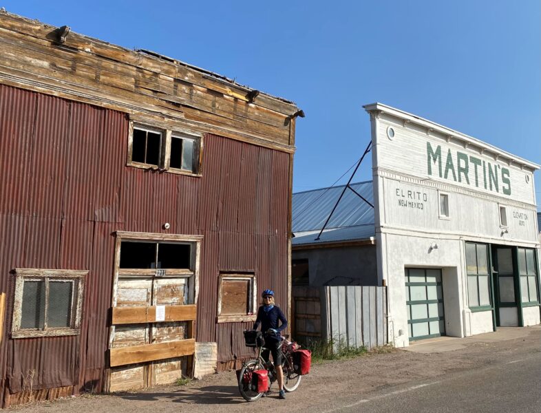
Refreshed, we set off along tarmac’d roads, passing through El Rico that looked like a set off a Western, and then started to climb a steep, but ridable, wooded track. Here was our first meeting of the “twins” who swept passed us at a speed on lightly loaded mountain bikes with their father. The twins were probably about 20 and they were intending to do the whole route. The first few weeks they were travelling with their father and the mother who took all the luggage and met them at the evening stops. We were to cross paths with twins many times from now on. Although faster than us they tended to get up and leave later than us.
It was also on this day that we spotted the first racer who had started in the North. He seemed relaxed and as fresh as a daisy despite the fact that, in less time than we had been on the trail, he had already covered over 2000 miles. He even had time to stop for a chat. An hour or two later we saw the second placed rider looking equally fresh.
Some of the trails now had warning signs such as; “Road not suitable for public if wet” or “Road impassable when wet”. Thankfully for us we still hadn’t had any rain and looked like we would leave New Mexico before the wet season was due to start. The tracks were heavily rutted but dry and ridable.
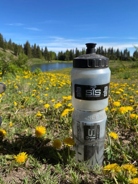
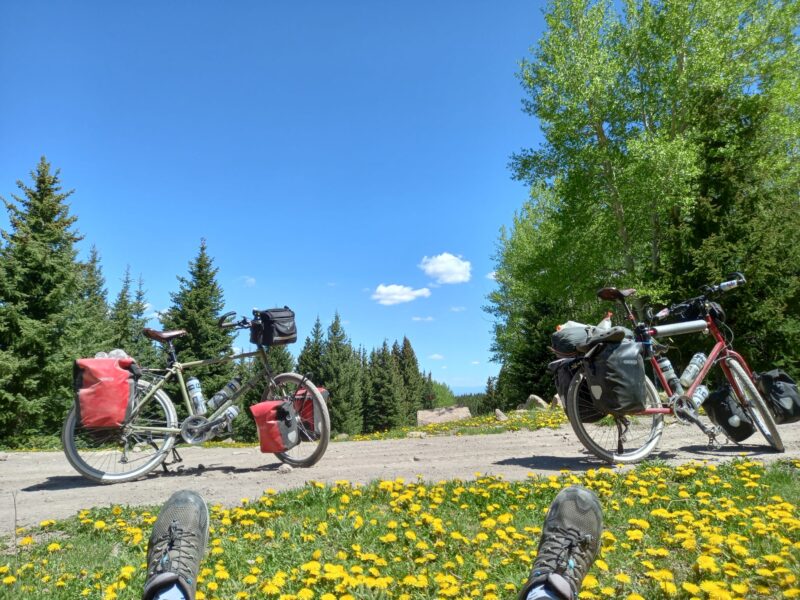
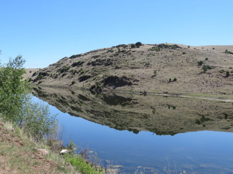
One night we camped between two lakes amongst thousands of yellow dandelions and surrounded by wooded mountains. Later the twins told us that they had swum in the Lower Lake and seen beavers. Unfortunately, we had missed them. Sally had a terrible night with a sore throat and swollen tonsils. We assumed it was a combination of the exertion, altitude, dust and dehydration.
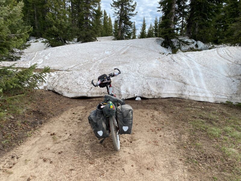
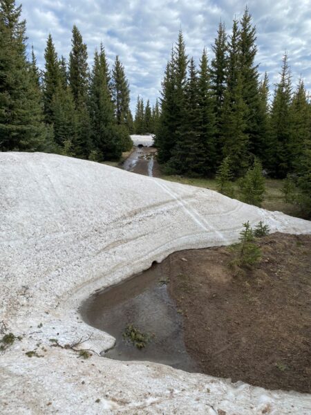
After leaving the lake the next 12 miles were particularly rough and took 5 hours of walking and only a few yards of cycling. In a couple of places our path was blocked by snow and fallen trees. We pushed on to reach 11000 ft for the first time and enjoyed a brew on the Brazo Ridge. A chance to recover from our shortness of breath
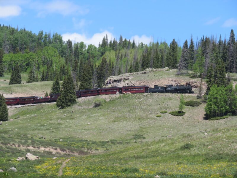
We descended by track to take lunch by a river just as steam train chugged across the opposite hillside on the Cumbres & Toltec Scenic Railway. Here we also saw the first southbound female racer, doggedly hugging the back wheel of a fellow competitor as they slogged up a long hill on the gravel. Shortly after we reached a tarmac’d road and we were in Colorado!
We had covered about 700 miles and climbed 42650ft and were 6 days in front of my planned schedule.