In Part 1 of this story in last month’s Anerley Gazette, I had left the mutinous troops asking – “Are we there yet?” – “Where’s the tea stop?” So it was a “Quick March!” to the nearest pub, which fortunately was not far away. A nice little country pub which I had discovered over 25 years ago when I had returned to my teenage interest in cycling. However my teenage bike, an Italian pseudo racer with Campag Double Clanger gear change, was then substituted with a mountain bike and Shimano triple chainset. Exploring the local bridleways on a hot summer’s day I had come across this lovely pub on Chelsham Green – in daylight hours – but this photo shows it off so much better!
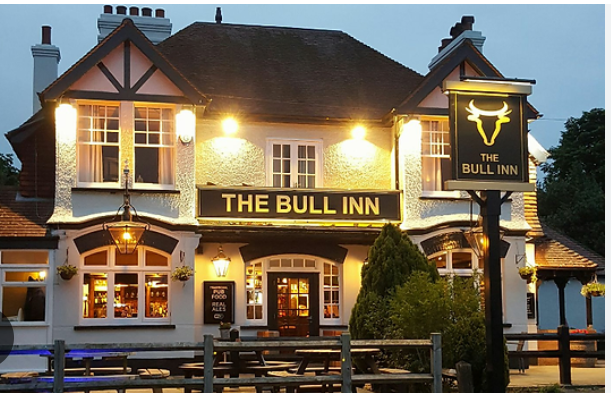
On this day of our winter hike, the pub was just as welcoming, but instead of the summertime cold beer, on this occasion it was hot drinks all round! But to set the scene and location, I need to return to an O.S map of the area.
In Part 1 we had got to the Trig point by Chelsham Court Farm and were about to go down Washpond Lane, at bottom right of the map section below. To give you some idea of where this area is, look at the red road, bottom left, which is identified as the B 269. To us it is better known as the Limpsfield Rd. Heading to the left on the B269, you will see the built up area of Warlingham, and the green square on the north side of the road, is the Sainsbury supermarket. And to the right of Sainsbury is the + sign indicating the Church. Heading to the right from Sainsbury along the red road (B269) would take you back up the hill to Botley Hill Farm.
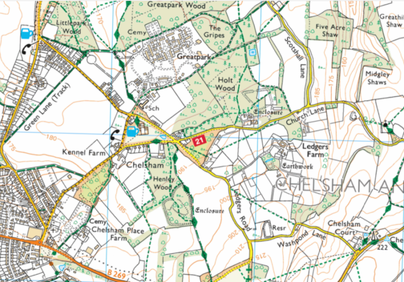
On the map section, if you follow the yellow road beside Sainsbury, north-east, you will see the blue beer glass, which is the Bull Inn on Chelsham Green. To the north of the Bull is an area identified as Great Park, which is surrounded by dotted lines that on O.S maps indicate footpaths. In my young days, Great Park was known as Warlingham Park Hospital (a mental hospital), but now the extensive grounds have been developed into a most scenic, upmarket, housing development. The clock tower below, is an original part of the old Victorian mental hospital, now surrounded by lovely grounds and houses. I understand that Martin Bates of Anerley B.C is one of the fortunate residents (not in the asylum I might add!)
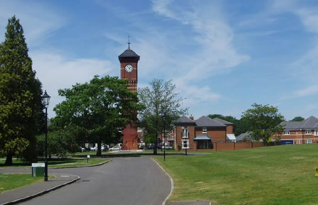
And another bit of O.S map history – O.S meaning Ordnance Survey – is that the weather vane on the top of the clock tower was also used as a Trig Point when the major mapping survey was done in 1936. The height of the clocktower and it’s weather vane being readily identifiable from a great distance away by a surveying crew .
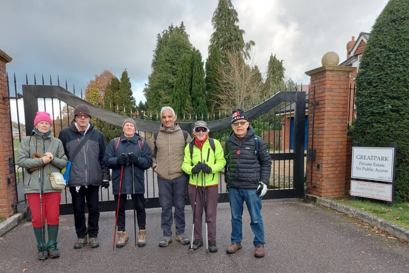
After our stroll around this enchanting estate we left by the main vehicle access – and it was time for another photo, taken by Jo Riffat our 7th member.
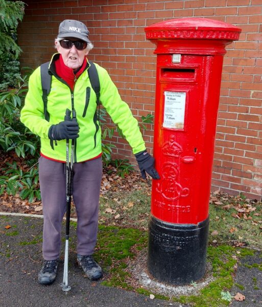
And for an Anerley version of the Southern Saunter map reading quiz, I could not resist this for a suitable subject!
Heading back along the road from the estate towards the Bull Inn, if you refer to the OS map again, you will note that the dotted path to the south west side of the Great Park, has some diamond shape markings. Do any of you know what this signifies? If you don’t it signifies a major long distance leisure route. In this case the Vanguard Way.
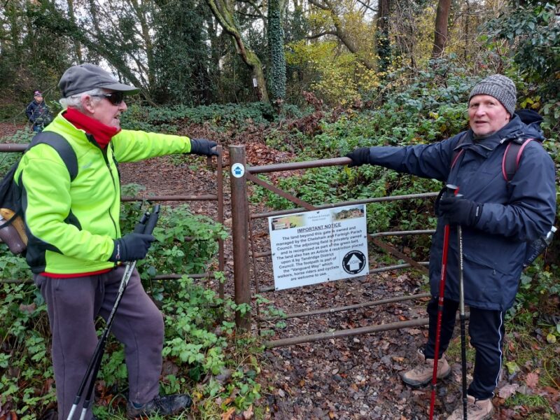

The Vanguard Way is a 66 mile hiking route starting at East Croydon railway station and ending on the beach at Cuckmere Haven, near Beachy Head. On our walk from Great Park and past the Bull Inn, we were on the Vanguard Way. This off road section, joined via the gateway shown above, took us nearly all the way back to Botley Hill Farm to end a very interesting day’s Anerley Winter Hike.
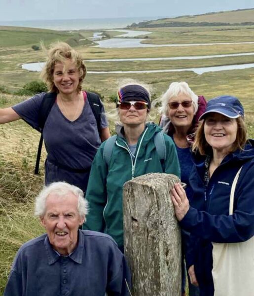
And to finish this write up, I must add that in August of this year, 6 off us had some Anerley Away Days based at Newhaven. During our stay we had a Summer Hike during which Tom Tom took this photo of us with Cuckmere Haven in the background. This was at the start of our day’s hike, which was along the southern end of the Vanguard way!
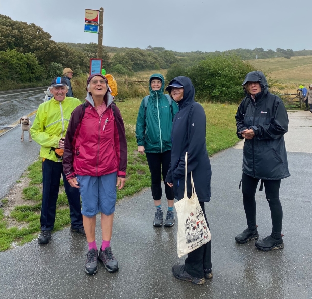
And below was at the end of the day’s hike – and the reason why we went for a hike rather than a bike ride.
Stormy weather! The forecast which turned out to be correct, was for torrential rain and 50 mph winds expected at circa mid-day – which turned out to be correct!
The next day was hot sunshine, beach, and ice cold beer!

Can’t wait for next summer!