Note this was written and the ride done in 2012.
Part of the excitement of a cycling tour is the planning, and as the saying goes, the devil is in the details. Where to go, how to get there, where to stay, etc. This is so much easier now with the huge amount of information readily available on the internet. Having decided on the basics, you can spend many more happy hours researching the finer detail, and over the past winter months I have been doing just that.
This year the destination was decided by Tom. He wanted to cycle the pilgrim’s route to Santiago de Compostela in Spain. This has long been a magnet for cyclists from around the world and has been the subject of many articles in cycle magazines. By chance there was a very interesting article in the C.T.C magazine at the end of last year. Reading it, any doubts that perhaps I was a little old for such an arduous ride, were dispelled by a surge of enthusiasm for this Spanish adventure!
As you may know, Tom is much involved with the South East Cancer Help Centre (S.E.C.H.C). When they heard about our intended trip they suggested that perhaps we might do it as a charity bike ride. How could we refuse!
Our numbers soon doubled. Tom’s eldest son Christopher wanted to join the team and has now become a very enthusiastic cyclist. Our foursome was made up with Ricky. He has a very special motive for joining the team. His daughter being very ill with cancer.
GETTING THERE.
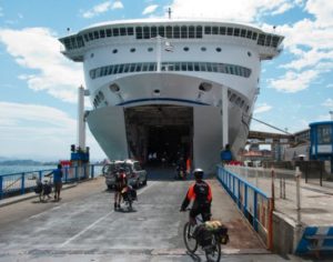
The Picos Riders board the ferry at Santander in 2010.
The S.E.C.H.C has organised our return ferry crossings, Portsmouth to Santander, with Brittany Ferries. The ferry company has generously provided our passage, including a 4-berth cabin, gratis! The normal cost is £970 (£265 each for the return trip). We have made a donation to the S.E.C.H.C for this amount, so our charity purse is guaranteed nearly £1,000 before we even start the ride!
A LONG AND WINDING ROAD.
The next bit to be determined was our cycle route, of which there are many that lead to Santiago. Many hours were spent studying maps and finding out about interesting places that we could visit en-route. Here the internet is invaluable, with Google maps and Via Michelin being particularly useful for foreign tours. Of these Via Michelin is my favourite, for 2 reasons. 1. Scenic roads are lined in green and on a cycle tour you want to see the best of the countryside! And 2. You can select a “Bike” option which automatically chooses a route via quieter roads which are better suited to cyclists. Whilst not perfect it is the best that you will be able to get for an area about which you have no prior knowledge.
When you come to do your European tour, Michelin Regional maps are in my opinion the most useful to take with you. They show adequate detail and the scaling means that they are easy to read. For some popular areas with tourists Michelin Zoom maps are at a larger scale and include cycle routes.
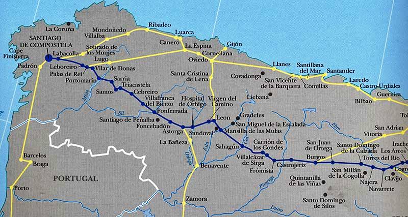
For our route to Santiago we settled on the most obvious, which is known as El Camino del Norte – the way of the north. This route starts on the coast at Irun in the Basque country by the border with France. Conveniently for us it passes thru Santander following an ancient Roman road, cutting inland at Ribedeo to cross over the mountains to our destination. The route provides stunning coastal scenery and lots of little fishing villages at which to enjoy a glass of Asturian cider with barbecued sardines. Or if we are more adventurous, octopus or some such Spanish delicacy!
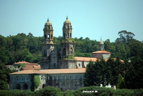
Having reached Ribadeo, the road inland starts a long climb, up and over the mountains where we hope to stay for one night at the beautiful monastery at Sobrado de los Mojes, shown on the diagram above. Los Mojes means the monks. Not too difficult to translate!
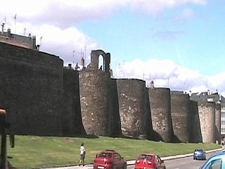
On the return journey, for a change of scenery, we will leave Santiago de Compostela via the Camino Frances (blue route on diagramatic map) and then divert onto the yellow route which is known as the Camino Primitivo. This will allow us to visit the World Heritage Site at Lugo and walk along it’s famous, encircling, Roman walls. From there we come to the most difficult part of our journey, three days in a mountain fastness, leading us to the city of Oviedo. From here we will divert to Covadonga and enjoy the not to be missed, Picos de Europa mountains.
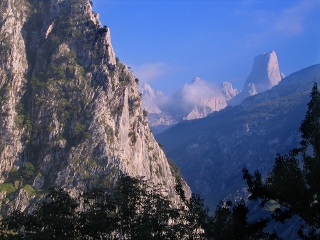
The Roman Walls of Lugo and The Stunning Picos mountains.
There was much more to be considered and decided, but from this basic outline for our intended journey, internet research and detailed planning could now begin. However, we are not of course doing this just for fun, but to raise money for the South East Cancer Centre. So please be generous, it will make our journey easier knowing that someone cares!
Donations can be made via JustGiving.com http://www.justgiving.com/el-camino or directly at the Centre. Their website is at http://www.sechc.org.uk/


Hi Picorider,
thank you for your usefull discription here and on the Santiago Forum. I am going to bike the Camino de la Costa from Bilbao to Santiago at the end of August. Now I am nit sure wether I understood you right: did you have the Micheline Material als gps track for your Smartphone or Android or did you use a map? I did some research and found out, that the Michelin App does not run offline… So was it very expensive, because of the roaming tax?
I would be very thankfull for a short note in the belonging.
Have a very nice day and best regards
Sonja from Deggendorf/Germany
Hi Sonja,
I used the Michelin paper map as my primary source, not an app. This was fine except in large towns where we often needed street maps to navigate through. For this, one of my companions downloaded a mapping programme onto his mobile phone (a Nokia I believe). This was not expensive and we would not have used it if it was! In addition he had downloaded our route onto a tablet, however this only worked when we had a free wifi connection, which was not all the time, and usually not available when needed!
At no time did we use GPS. We could have done the ride without the help of the mobile phone as I did the route some 5 years ago before mobiles with app were available.
I see that you are from Germany. We have just got back from 10 days cycling down the Mosel, Trier to Koblenz, and then back up the Rhine to Rudesheim, returning across the Hunsruck to the Mosel and Trier. Very enjoyable, unlike Spain, mainly flat!
I have just started to write up our ride, the first 2 parts are at: http://anerleybc.org/the-german-tour-stage-1/ and http://anerleybc.org/the-german-tour-stage-2/
You will greatly enjoy your ride to Santiago, we did!
Buen Camino,
Des.
Hi Picorider,
many thanx for our usefull information! I will follow your advice an buy a michelin paper map, too. Already I was a bit lost in the navigation dschungle on the internet; too much information sometimes! Most of us are just user, right? No pc professionells! Loveley tour you did right now!
Best regards
Sonja
Hi Sonja,
This may or may not be of interest, but it does provide some information about maps. It also says a bit about Michelin paper maps which we used when we went to Santiago, and gives details of the Michelin mapping web site for greater detail than is practical with paper maps. I used the mapping web site during planning of our journey and copied off a few bits where more detail was useful (example in the major towns).
See my item at http://anerleybc.org/maps-and-navigation-start-here/
Des.
P.S. Wasn’t it awful, the train crash at Santiago.